


Stevens Point - C 11 Voting District, Portage County, Wisconsin
About
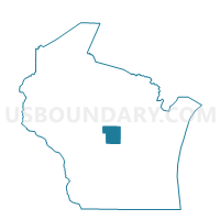
Outline

Summary
| Unique Area Identifier | 696229 |
| Name | Stevens Point - C 11 Voting District |
| County | Portage County |
| State | Wisconsin |
| Area (square miles) | 0.50 |
| Land Area (square miles) | 0.35 |
| Water Area (square miles) | 0.15 |
| % of Land Area | 69.70 |
| % of Water Area | 30.30 |
| Latitude of the Internal Point | 44.50498510 |
| Longtitude of the Internal Point | -89.55262090 |
Maps


Graphs
Select a template below for downloading or customizing gragh for Stevens Point - C 11 Voting District, Portage County, Wisconsin


Neighbors
Neighoring Voting District (by Name) Neighboring Voting District on the Map
- HULL - T 8 Voting District, Portage County, WI
- PLOVER - T 3 Voting District, Portage County, WI
- Stevens Point - C 12 Voting District, Portage County, WI
- Stevens Point - C 20 Voting District, Portage County, WI
- Whiting - V 1 Voting District, Portage County, WI